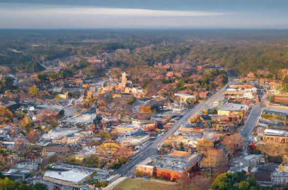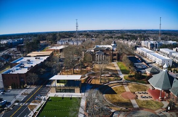

Experience precise, high-resolution mapping from above, transforming your projects with detailed topographical data and 3D models.
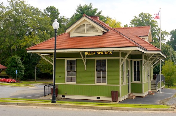
At Airborne Drone Services, we use the latest in drone technology to provide precise, high-resolution aerial mapping services that offer a detailed and accurate view of any location. Based in Atlanta and serving clients throughout Georgia, we specialize in creating comprehensive drone mapping solutions that are invaluable for industries like construction, land development, agriculture, and environmental management. Our aerial mapping services help streamline planning, improve accuracy, and provide critical data for decision-making.


What Is Drone Mapping?
Drone mapping involves the use of drones equipped with high-resolution cameras and sensors to capture detailed aerial imagery of a designated area. These images are then processed and stitched together to create orthomosaic maps, 3D models, or topographic data. The result is an accurate, detailed visual representation of the landscape, which can be used for a wide range of applications. Unlike traditional ground surveys, drone mapping is faster, more cost-effective, and capable of covering large areas with precision.
Whether you’re managing a construction site, monitoring agricultural land, or planning a development, our aerial mapping and drone mapping services provide the data you need to make informed decisions and ensure your project’s success.
Benefits of Drone Mapping
Using drone mapping offers several key advantages over traditional methods. The speed at which drones can capture large areas significantly reduces the time it takes to complete surveys or collect data. With the ability to fly over difficult terrain or hard-to-reach areas, drones can access places that may be inaccessible or dangerous for ground crews. This means safer, faster data collection that doesn’t compromise on quality.
Additionally, drone mapping provides incredibly detailed, high-resolution images, allowing for precise measurements and in-depth analysis. Whether you’re looking to measure distances, calculate volumes, or monitor changes in the landscape over time, the accuracy and clarity of aerial mapping are second to none.
Accuracy and Precision You Can Trust
At Airborne Drone Services, we understand the importance of accuracy and precision in aerial mapping. Our team of skilled drone operators uses state-of-the-art equipment to ensure that every map we create is both detailed and reliable. We work closely with our clients to understand their specific needs and deliver maps that are tailored to their project requirements.
Whether you need a basic orthomosaic map, a detailed 3D model, or complex topographic data, our drone mapping services provide high-quality results that you can trust. Our commitment to professionalism and attention to detail ensures that every project is completed with the highest level of accuracy.
Applications of Drone Mapping
Drone mapping is a versatile tool used across a wide range of industries. Some of the most common applications include:
Construction and Land Development
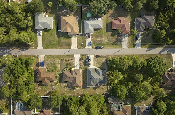
Accurate site surveys are essential for construction and land development projects. With aerial mapping, contractors and developers can quickly obtain detailed information about a site’s topography, boundaries, and layout. This data helps ensure accurate planning, grading, and resource allocation, ultimately improving project efficiency and reducing costs. By creating 3D models or digital elevation maps (DEMs), developers can visualize the terrain and plan accordingly.
Agriculture
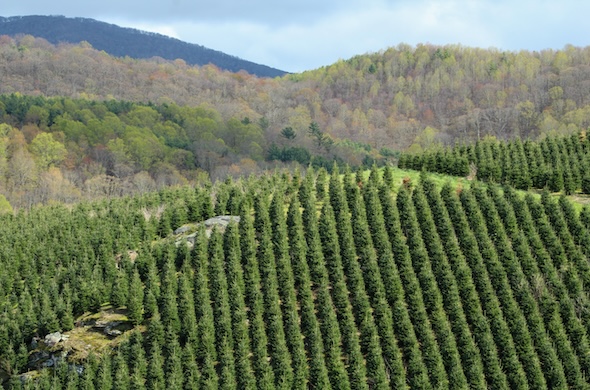
For agricultural professionals, aerial mapping is a powerful tool for managing crops and land. Drone mapping helps assess crop health, monitor field conditions, and identify areas that may need attention, such as irrigation or pest control. By generating NDVI (Normalized Difference Vegetation Index) maps, drones can help farmers make data-driven decisions that lead to better yields and more efficient land use.
Environmental Management
Environmental monitoring and land conservation efforts benefit greatly from drone mapping. By providing high-resolution, up-to-date aerial images, our services assist in tracking environmental changes, monitoring erosion, assessing vegetation health, and mapping out protected areas. Drone mapping is particularly useful for monitoring large areas over time, allowing for ongoing assessment of the environmental impact and the effectiveness of conservation strategies.
Mining and Resource Management
In the mining and resource extraction industries, drone mapping provides valuable data for volumetric calculations, site planning, and safety assessments. Accurate maps allow for more efficient resource management, helping companies calculate stockpile volumes, monitor site changes, and ensure safety regulations are being followed. The ability to quickly gather data over vast areas helps minimize downtime and improves operational efficiency.
Serving Georgia’s Mapping Needs
From Atlanta to rural Georgia, we serve clients across the entire state, offering drone mapping solutions for industries of all types and sizes. Whether you’re managing a large-scale construction project, monitoring agricultural land, or overseeing environmental conservation efforts, our aerial mapping and drone mapping services provide the detailed data you need to succeed. We bring the latest in drone technology to every job, ensuring that you receive the best service possible.
Contact Us for Drone Mapping Services
We Are At The Controls

DJI Air 3
Our DJI Air 3 captures stunning, high-definition aerial footage and precise details for any project, from real estate to detailed inspections.

DJI Mini SE
With the DJI Mini SE, we provide crisp, scenic shots for events, landscapes, and smaller-scale projects.

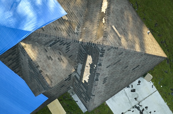
Eagleview
Using EagleView’s advanced software, we deliver safe, accurate roof and property assessments with clear, AI-enhanced imaging and automated reporting.