
Detect hidden inefficiencies and potential issues with our advanced thermal imaging technology, providing critical insights for smarter decision-making.
At Airborne Drone Services, we offer advanced thermal mapping solutions that provide invaluable insights through heat detection and analysis. Based in Atlanta and serving all of Georgia, our thermal mapping services are designed to help businesses, property managers, and industrial sectors uncover hidden issues that may not be visible to the naked eye. From identifying heat loss in buildings to detecting faults in electrical systems, our drone-based thermal imaging technology offers a fast, efficient, and non-invasive way to gather critical data.


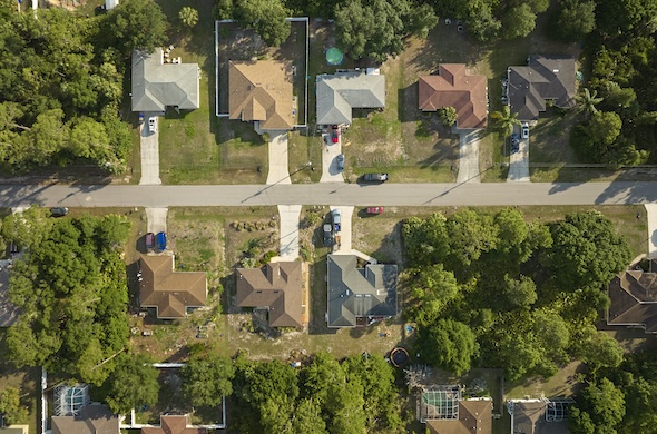
What Is Thermal Mapping?
Thermal mapping uses infrared sensors to capture temperature variations across surfaces, providing detailed images that reveal heat patterns and irregularities. When mounted on drones, these sensors enable us to map large areas or hard-to-reach places quickly and accurately, offering insights that traditional inspections might miss. Thermal maps are used across many industries to improve energy efficiency, assess equipment performance, monitor environmental changes, and more.
Whether you’re managing a large facility, conducting maintenance checks, or assessing the health of your infrastructure, our thermal mapping services help you make informed, data-driven decisions.
Benefits of Drone-Based Thermal Mapping
Thermal mapping with drones offers numerous advantages over traditional methods. One of the biggest benefits is the ability to safely inspect areas that may be hazardous or difficult to access, such as rooftops, solar panels, power lines, or industrial sites. The non-invasive nature of drone inspections allows us to collect accurate data without disrupting operations or causing damage to sensitive equipment.
The precision of drone thermal imaging also allows for early detection of potential problems, such as energy loss, electrical faults, or mechanical failures. Identifying these issues early can lead to significant cost savings by preventing downtime, avoiding expensive repairs, and improving overall operational efficiency. Additionally, our drones can cover large areas quickly, reducing the time and labor required for inspections.
Precision and Expertise You Can Trust
At Airborne Drone Services, we combine cutting-edge drone technology with expert knowledge to provide thermal mapping solutions that meet the highest standards of accuracy and reliability. Our FAA-certified drone pilots are experienced in operating thermal imaging equipment, and we adhere to all industry safety and compliance regulations. We work closely with our clients to understand their unique needs and deliver thermal maps that provide actionable insights, whether for improving energy efficiency, maintaining infrastructure, or conducting preventative maintenance.
With our thermal mapping services, you’ll receive detailed reports and high-resolution thermal images that help you make informed decisions quickly and efficiently. Our commitment to quality and professionalism ensures that every project is executed with precision and care.
Serving All of Georgia
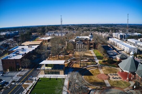
From Atlanta to rural areas across Georgia, Airborne Drone Services is proud to serve clients statewide. No matter the size or scope of your project, our thermal mapping services are designed to deliver fast, reliable, and cost-effective results. Whether you need to inspect a single building, a solar farm, or a large industrial facility, we are here to provide the data you need to improve performance, efficiency, and safety.
Applications of Thermal Mapping
Thermal mapping has a wide range of applications across various industries. Some of the most common uses include:
Building and Energy Efficiency
For property managers, building owners, and energy auditors, thermal mapping is an essential tool for identifying energy inefficiencies. Drones equipped with thermal cameras can detect heat loss, poor insulation, air leaks, and other inefficiencies in residential, commercial, and industrial buildings. By pinpointing problem areas, our thermal mapping services help improve energy efficiency, lower utility costs, and support sustainability initiatives. The ability to visualize temperature differences across a building’s exterior or roof provides critical data for making informed decisions on repairs and upgrades.
Solar Panel Inspection
In the solar energy sector, maintaining optimal performance of photovoltaic (PV) panels is critical to maximizing energy output. Thermal mapping helps identify malfunctioning or damaged panels by detecting irregular heat patterns that indicate faults. Whether it’s a single solar array or an entire solar farm, our drones can scan large installations efficiently, allowing operators to spot potential issues before they escalate into costly problems. Early detection of hot spots, shading problems, or wiring issues helps ensure that solar energy systems run at peak efficiency.
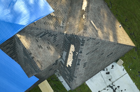
Roofing and Infrastructure Inspections
Thermal mapping is especially useful for roofing inspections, particularly in identifying moisture intrusion, insulation failures, or leaks that can lead to costly damage. With our drone-based thermal imaging, we can safely and accurately assess roof conditions without the need for invasive inspections or scaffolding. Whether it’s a commercial facility or a residential property, thermal maps provide clear visual data on areas that may require immediate attention or long-term maintenance planning.
For other infrastructure, such as bridges, pipelines, or electrical systems, thermal mapping can detect heat anomalies that suggest stress, corrosion, or mechanical failure. This makes it an invaluable tool for asset management, allowing companies to maintain the integrity of critical infrastructure and prevent costly outages or repairs.
Industrial and Electrical Inspections
In industrial settings, thermal mapping is widely used for inspecting electrical systems, machinery, and manufacturing processes. By detecting overheating components, thermal imaging can help prevent equipment failure, reduce the risk of fire hazards, and ensure that electrical systems are operating safely and efficiently. Drones allow us to conduct thermal inspections in challenging environments, including high-voltage areas or confined spaces, reducing the need for manual inspections that may pose safety risks.
For manufacturing plants, refineries, or power stations, thermal mapping can be integrated into regular maintenance programs to ensure that machinery is running optimally and that any heat-related anomalies are addressed before they cause downtime or costly repairs.
Contact Us for Your Thermal Mapping Needs
If you’re ready to take advantage of the latest in thermal imaging technology, contact Airborne Drone Services today. Our drone-based thermal mapping services offer a safe, accurate, and non-invasive way to detect issues and improve efficiency across a wide range of industries. Let us help you uncover hidden problems and make informed decisions that can save time and money.
Reach out today to schedule a consultation and see how our thermal mapping services can benefit your business, property, or project!
We Are At The Controls

DJI Air 3
Our DJI Air 3 captures stunning, high-definition aerial footage and precise details for any project, from real estate to detailed inspections.

DJI Mini SE
With the DJI Mini SE, we provide crisp, scenic shots for events, landscapes, and smaller-scale projects.

Eagleview
Using EagleView’s advanced software, we deliver safe, accurate roof and property assessments with clear, AI-enhanced imaging and automated reporting.